
Lago Quilotoa (Caldera-Crater Lake), Ecuador
Quilotoa
Ecuador
October 10, 2013
My Dear Mountaineers,
The Quilotoa Loop is the scenic route west from Latacunga (pop 87,417) to the remote towns of Pujili, Tigua (pop 3000) and Zumbahua (pop 3000). North of Zumbahua, along the Rio Toachi, lies Quilotoa (Pop 150, Elev 3914m, 12,841 ft, 2.4 miles high!!).
The paved and curvy road is easy to navigate although my cute little Chevrolet Spark struggles to ascend from 2800m in Latacunga to Quilotoa at 3914m. To make any headway at all, I must constantly downshift from 3rd gear to 2nd. 
The mountain and valley scenery is a mixture of rugged terrain and patchwork farms that climb the steep and fertile volcanic slopes. I also visited a local cemetery.
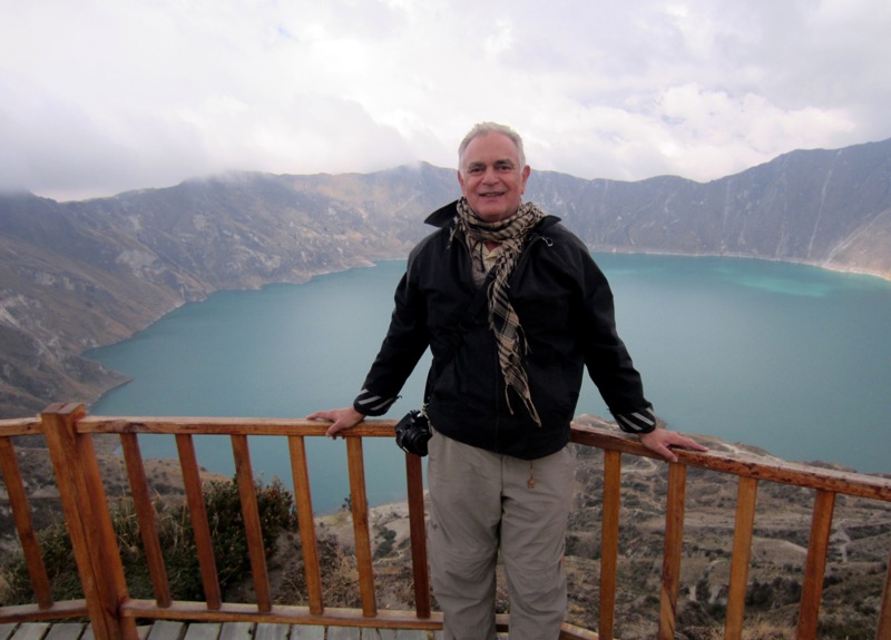
Who can adequately describe Laguna Quilotoa? My guidebook describes the volcanic crater lake as a “gasp-inducing” sight. I choose to use no words at all. It’s simply a place “To See.”
The mirror green lake lies 400m below the rim. The indigenous locals who have lived here forever insist the lake has no bottom. That seems entirely plausible. Modern geologists say the lake is 250m deep. Hey, what do they know?
Several mountaineers (a couple of years younger than me) hike from the rim down to the lake and back in about an hour. But since my right arm and left leg are already exhausted from the drive, I smile, take my photos and head back to town.
I did make a short video.
Gasping Jan